History & How It Was Built
History of Key Colony Beach, Florida — learn how this man-made island was built from Shelter Key in the 1950s, why it’s elevated, and why booking direct saves you money. Is Key Colony Beach man-made? How was it built? So when was it developed?

History & How Key Colony Beach Was Built
Is Key Colony Beach Man-Made? How Was It Built? So when Was It Developed?
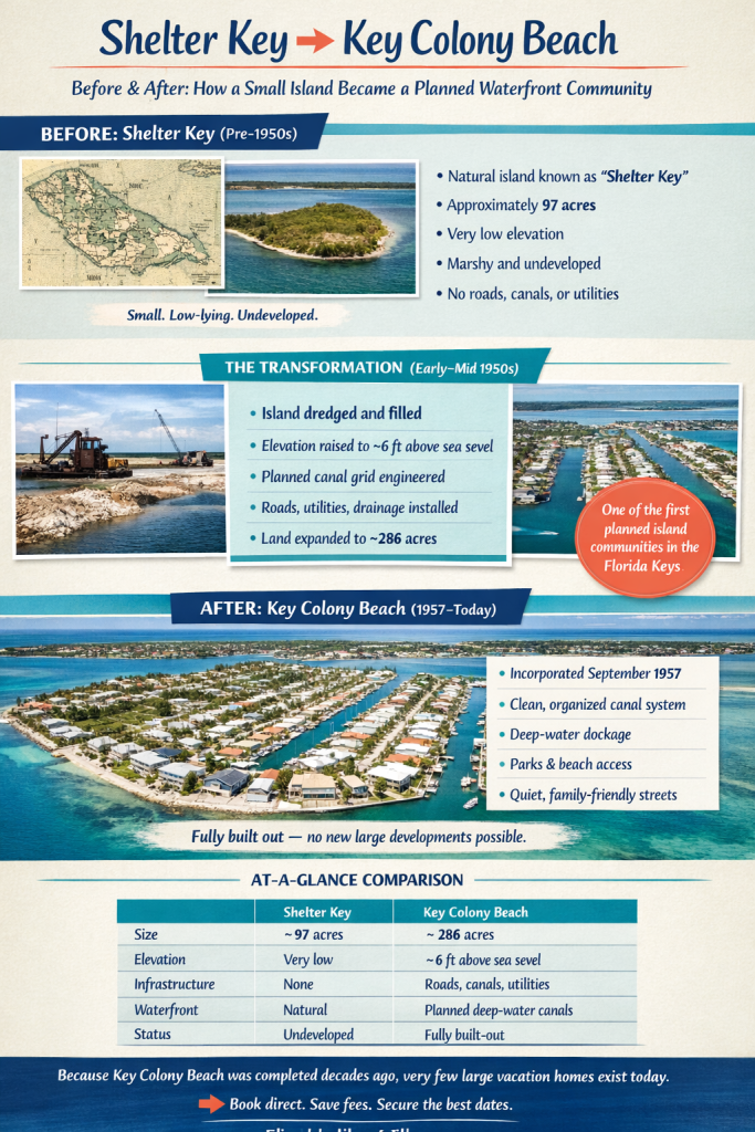
Yes — Key Colony Beach is a man-made island community, carefully planned and developed in the 1950s from a much smaller natural island once known as Shelter Key.
📜 Before the 1950s: Shelter Key
Before development began, the island was called Shelter Key. At that time:
- So It measured about 97 acres
- Because It was low-lying and marshy
- Therefore, It had limited elevation, making permanent structures impractical
Because of these limitations, the island remained largely undeveloped for decades.
🚧 The 1950s: How Key Colony Beach Was Built
In the early 1950s, developer Phil Sadowski envisioned something entirely new for the Middle Florida Keys.
To make that vision possible:
- So the island was dredged and filled
- And Elevation was raised to approximately 6 feet above mean sea level
- So a planned grid of canals was created
- Roads, utilities, and infrastructure were installed simultaneously
As a result, the land expanded from roughly 97 acres to about 286 acres, transforming Shelter Key into a safe, elevated, and navigable island community.
🏛️ Incorporation & Official Recognition
- So Key Colony Beach was officially incorporated in September 1957
- Therefore It became one of the first planned residential island communities in the Florida Keys
- The design prioritized:
- Waterfront living
- Boating access
- Also Walkability
- Quiet residential streets
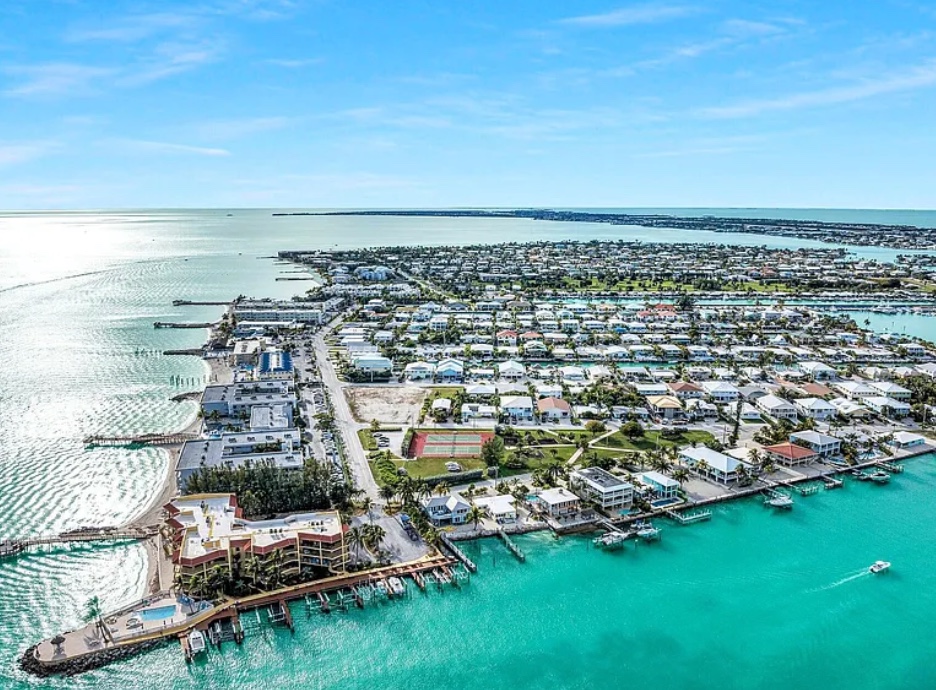
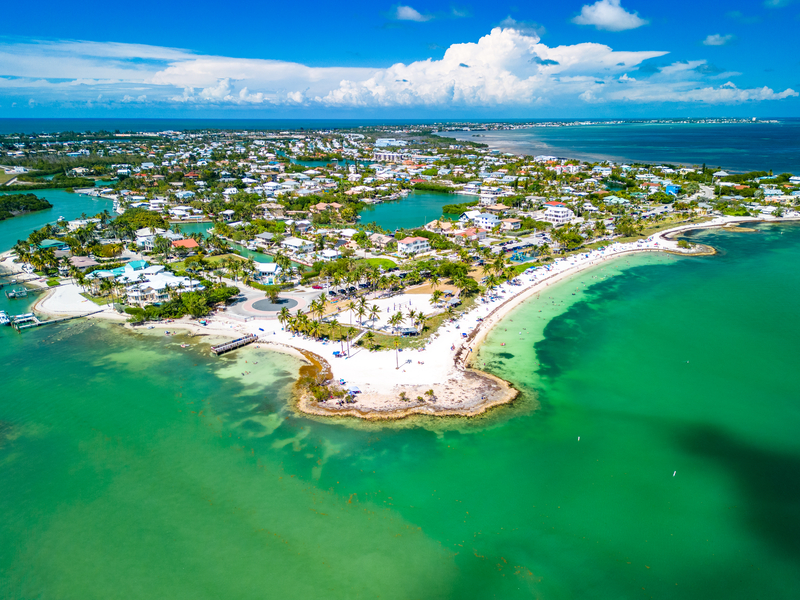
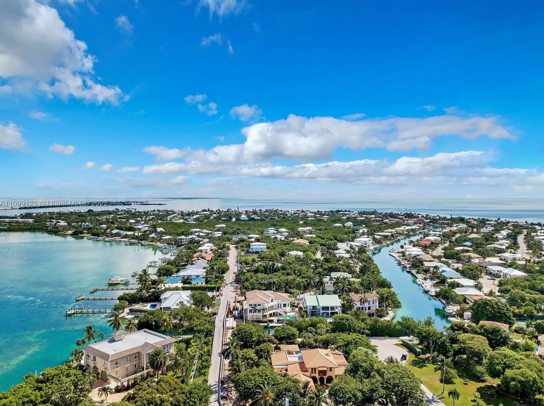
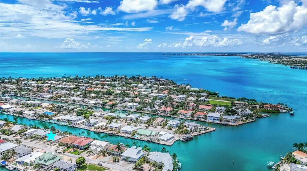
🌴 Key Colony Beach Today
Today, Key Colony Beach is known for:
- A clean, organized canal system
- Deep-water dockage for boats
- Small parks and beach access points
- A peaceful, family-friendly atmosphere
- Minimal traffic and no nightlife scene
Equally Importantly, very few large vacation homes exist on the island, which makes availability extremely limited — especially for families traveling together.
🎣 Local Tip (Why This History Matters to Visitors)
The canals created during development now provide excellent boating and fishing access, with many homes offering direct dockage. This makes Key Colony Beach one of the most convenient places to stay for boaters, anglers, and families who want waterfront access without crowds.

🏡 Why Booking Direct in Key Colony Beach Matters
Because Key Colony Beach is small, fully built-out, and highly regulated, there are no new large vacation homes being added.
That means:
- Therefore, Inventory is extremely limited
- So prime dates sell out early
- Because Booking direct helps you:
- And avoid third-party service fees
- Also communicate directly with local hosts
- Plus get better cancellation flexibility
- Secure returning-guest priority
👉 Book direct and save with
FloridaKeysVillas.com
(Internal anchor text placed here intentionally for SEO authority and user intent)

Book Direct & Save at 711 8 Street Key Colony Beach, Florida. Florida Keys Villas.com
🎤 Voice Search–Optimized FAQs (Google, Siri, Alexa, Bing)
“Is Key Colony Beach man-made?”
Yes. because Key Colony Beach was expanded and elevated in the early 1950s from a small island called Shelter Key and officially incorporated in 1957.
“How was Key Colony Beach built?”
Key Colony Beach was built by dredging and filling the original island, raising it above sea level, and constructing a planned canal and road system.
“When was Key Colony Beach developed?”
Because Key Colony Beach was developed in the early 1950s and incorporated as a city in September 1957.
“Why is Key Colony Beach so unique?”
Key Colony Beach is unique because it is a fully planned island with canals, limited housing, quiet streets, and easy boating access — unlike many other Keys destinations.
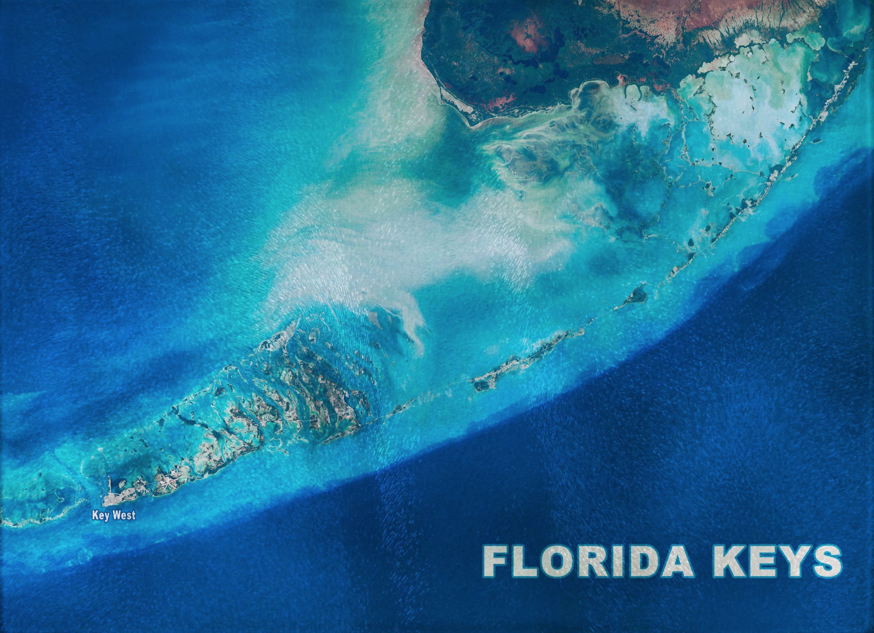
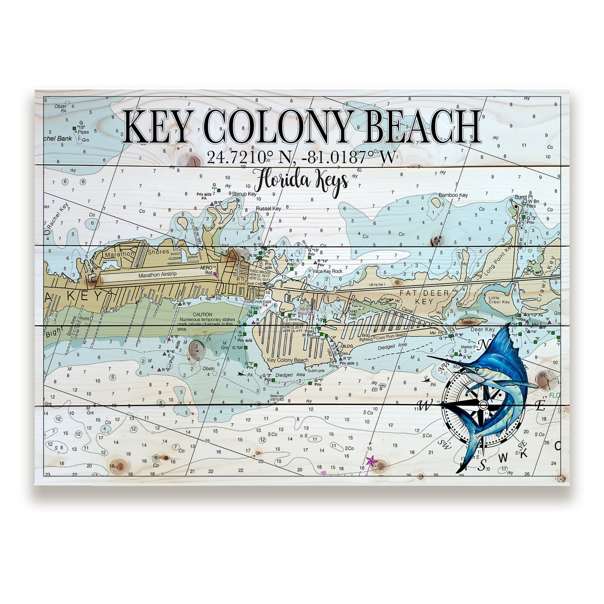
🗺️ Historical Maps & Images of Key Colony Beach (What Exists)
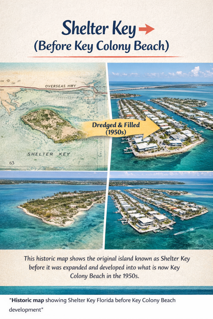
1. Pre-Development Maps (Shelter Key Era – pre-1950s)
Florida Keys Historical Map in the Keys. Shelter Key (Before Key Colony Beach) FloridaKeysVillas.com
These maps typically show:
- Shelter Key as a small, irregular island
- No canal grid
- No road system
- Often unlabeled or lightly referenced
- “Shelter Key (Before Key Colony Beach)”
2. Aerials During Development (1950s–1960s)

Key Colony Beach Aerial Views Development 1950 to 1960 FloridaKeysVillas.com

Key Colony Beach development in the 1950s. Picture of Dredging and Creating Canals and land for Key Colony Beach. FloridaKeysVillas.com
You’ll find:
- Early canal cuts
- Partial land fill
- Roads appearing before homes
- Clear before/after contrast potential
3. Early Canal & Plat Maps (Original Planning Documents)
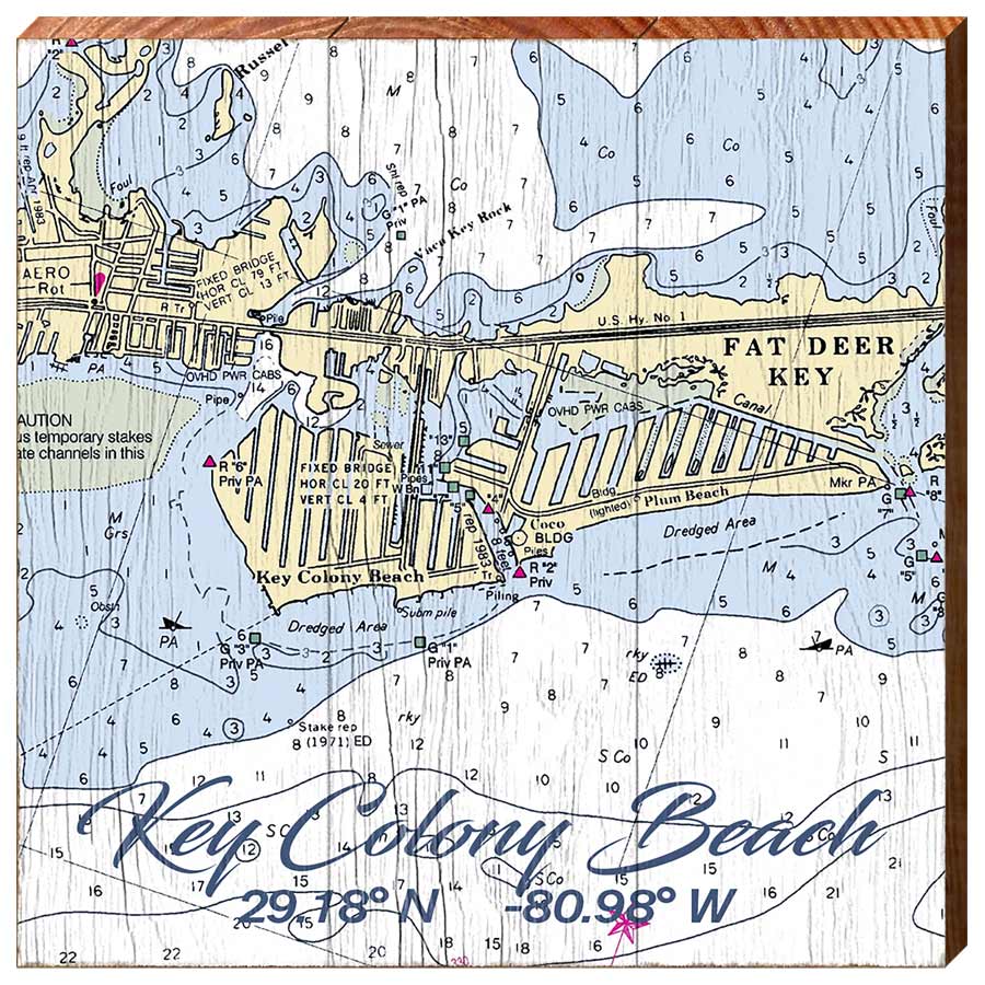
These show:
- The intentional canal grid
- Lot divisions
- Planned parks and access points
- Proof that this was a designed community, not organic sprawl
4. USGS & Government Topographic Maps
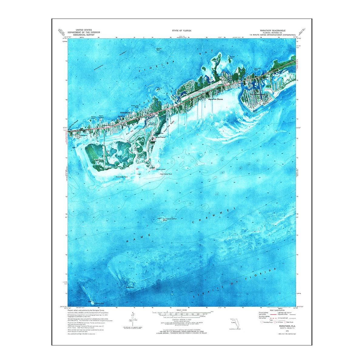
These confirm:
- Elevation changes
- Man-made land expansion
- Official federal recognition of the new island
🔎 Where These Images Usually Live (Behind the Scenes)
Because you won’t always find these by Googling “Key Colony Beach history.” Instead, they’re often archived under:
- Monroe County historical records
- Florida Memory Project
- USGS map archives
- University of Florida digital collections
- Old developer plats (Sadowski-era filings)
Because Key Colony Beach was fully built out decades ago, there are very few large vacation homes available today. Booking direct ensures access to the best dates before they’re gone.
Book Direct for Large Waterfront Villas in the Key Colony Beach. FloridaKeysVillas.com

👉 Book direct with FloridaKeysVillas.com